
FCF MTB site – Provence Verdon – Track 3 – Black – The Grand Tour
- 2 days
- Very difficult
- 145 km • 2,480 m gain • Loop
- Marked route
- Ginasservis
- La Verdière
- Montmeyan
- Riez
- Artignosc-sur-Verdon
- Régusse
and 6 other municipalities
Vinon-sur-Verdon, Gréoux-les-Bains, Roumoules, Saint-Martin-de-Brômes, Valensole, Montagnac-Montpezat
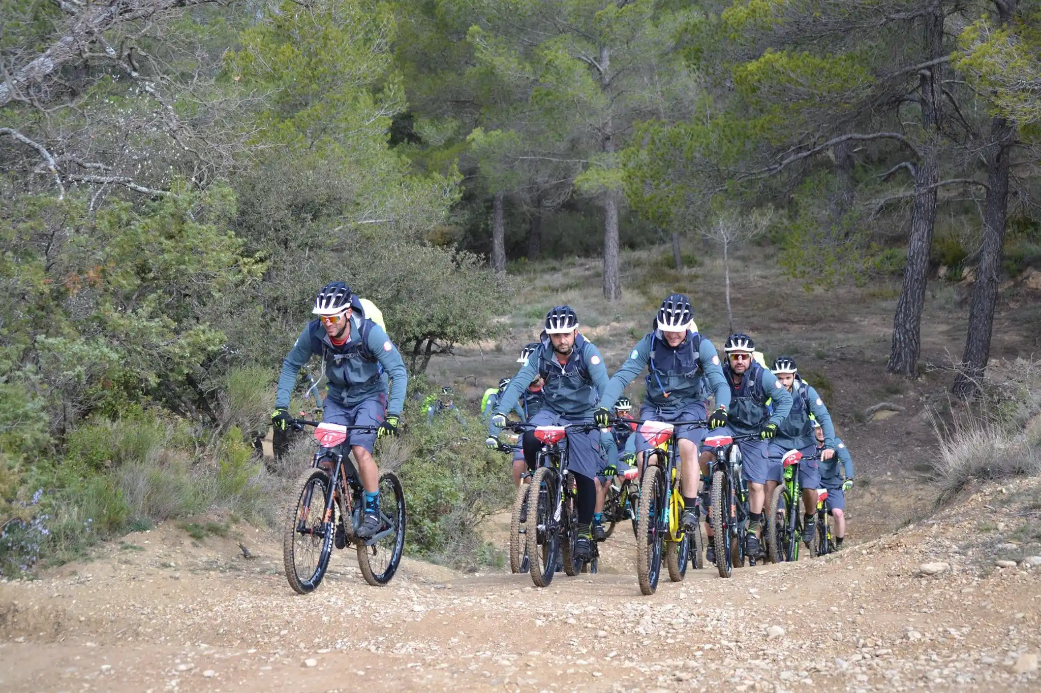
Track 3 of the FCF MTB site Provence Verdon
From Gréoux-les-Bains, Vinon-sur-Verdon, Ginasservis, La Verdière, Montmeyan, Régusse, Artignosc-sur-Verdon, Montpezat, Montagnac, Roumoules, Riez, Valensole and Saint-Martin-de-Brômes, follow the track 3 marked black.
Enjoy 360° views over the Haut-Var plateaux and the Valensole plateau.
Can be done over 2/3 days.
The incredible grand MTB tour of the Provence Verdon MTB site. From the lavender fields of the Valensole plateau to the turquoise waters of the Verdon Gorges and lakes, via the lush green hills of the Haut-Var: this grand tour is sure to be a colourful experience. It’s a smooth route but it can be a bit bumpy at times.
Openings
All year round daily.
Before going on the track, check whether access to forest areas is authorised: https://www.risque-prevention-incendie.fr/alpes-de-haute-provence/ and https://www.risque-prevention-incendie.fr/var/.
- Distance
- 145 km
- Duration
- 2 days
- Elevation gain
- +2,480 m
- Elevation loss
- −2,480 m
- Max. altitude
- 677 m
- Activity
- Cycling sports
- Waymarking
- Marked route

Office de Tourisme de Gréoux-les-Bains
Place de l'Hôtel de Ville
Au départ du Parking des Marronniers
04800 Gréoux-les-Bains
France
Phone : 04 92 78 01 08
Email : contact@provenceverdonvtt.fr
Web site : https://provence-verdon-vtt.fr/
Facebook : https://www.facebook.com/VTTProvenceVerdon
The route
Profile description
Start at 309 m, finish at 305 m at km 145.0. Highest point at 677 m at km 100.3. From km 0.0 to km 100.7: climb from 309 m to 677 m. From km 100.7 to km 143.9: descent from 677 m to 303 m. From km 143.9 to km 145.0: almost flat, around 305 m.
Altitudes completed by IGN (RGE ALTI®).
Delicate passages
Présence potentielle de pastoralisme et chiens de protection (Ayez les bons réflexes : ralentir et descendre du vélo, contourner le troupeau, laisser le chien vous identifier en gardant son calme, ne pas le caresser/nourrir ainsi que le troupeau)
Waymarking
Brown FCF markings and number 3 Black: the track is punctuated by crossroads with directional signs.
Where to eat
 at km 0.2 · on the routeLe CabanonGréoux-les-Bains
 at km 0.2 · 401 m from the trackLa Table de PaulineGréoux-les-Bains
 at km 0.2 · 234 m from the trackBistrot du CasinoGréoux-les-Bains
 at km 0.2 · 234 m from the trackCafé ColomberoGréoux-les-Bains
- at km 0.3 · 682 m from the trackRestaurant la ChêneraieGréoux-les-Bains
 at km 0.3 · 122 m from the trackRestaurant Le Pavillon – Hôtel Villa CastellaneGréoux-les-Bains
- at km 0.4 · 82 m from the trackDoudou PizzaGréoux-les-Bains
 at km 0.4 · 61 m from the trackL’ArlequinGréoux-les-Bains
- at km 0.5 · on the routeLa Brasserie du SoleilGréoux-les-Bains
- at km 0.5 · on the routePizza LoloGréoux-les-Bains
 at km 0.5 · on the routeL’ArdoiseGréoux-les-Bains
 at km 0.6 · on the routeLe Jardin des LilasGréoux-les-Bains








Download the document
Plans and layouts
- Download the track gpx ( Track 3 – Start from Gréoux-les-Bains – GPX )
- Download the track gpx ( Track 3 – Start from Vinon-sur-Verdon – GPX )
- Download the track gpx ( Track 3 – Start from Ginasservis – GPX )
- Download the track gpx ( Track 3 – Start from La Verdière – GPX )
- Download the track gpx ( Track 3 – Start from Montmeyan – GPX )
- Download the track gpx ( Track 3 – Start from Régusse – GPX )
- Download the track gpx ( Track 3 – Start from Artignosc-sur-Verdon – GPX )
- Download the track gpx ( Track 3 – Start from Montpezat – GPX )
- Download the track gpx ( Track 3 – Start from Montagnac – GPX )
- Download the track gpx ( Track 3 – Start from Roumoules – GPX )
- Download the track gpx ( Track 3 – Start from Riez – GPX )
- Download the track gpx ( Track 3 – Start from Valensole – GPX )
- Download the track gpx ( Track 3 – Start from Saint-Martin de Brômes – GPX )